
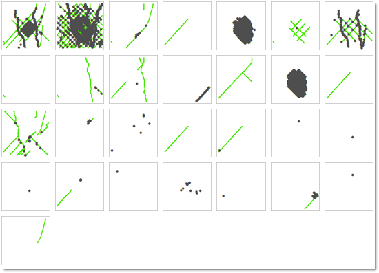
 Small multiple maps are one way to visualize the full set of contributors and the influence of each. This map shows all contributors to OSM in Tres Arroyos, Argentina between the project’s inception and the end of 2014. The maps are sorted from top to bottom (reading left-to-right) based on the contributor’s number of unique days active in the project. Maps such as these can highlight the division of labor between the more casual mappers, the more systematic mappers, and automated activities such as bot fixes or imports.
When studying the free-form comments left by OSM contributors and linking it to the geographic data , it becomes clear that small cities in OSM are a crossroads of hobbyists, bots, paid mappers, imagery tracers, importers, and a small handful of people who know and love the region, but may not be from the town itself. This broad variety of influences disrupts the original notion of volunteered geographic information as being contributed by individual “citizen sensors” sharing primarily local knowledge.
View a talk about the project
This talk at State of the Map US 2015 focuses on OSM construction in the city of Salina, Kansas. It compares growth in this town with larger cities in the region and other small towns in North and South America.
Read more
Quinn, S. Using small cities to understand the crowd behind OpenStreetMap. GeoJournal. doi: 10.1007/s10708-015-9695-6 [HTML link to article]